An interpretation of the Illyrian city of Byllis, informed by the park’s history and the supplied photographs. The agora, theatre and stoa guide the scene; building forms, layout, river view and vegetation are hypotheses awaiting archaeological review. The proposed date is the third to second century BCE. This is an AI-generated still with camera animation, not a surveyed 3D reconstruction.
From evidence to reconstruction
The cinematic scene guides appearance. The 3D city brings together monuments from identified periods without claiming they all coexisted at one date. Plans, photographs and reconstruction proposals are documented separately. Park history ↗
Beyond the model
Notes on this study
01
The theatre
Illyrian civic period · proposed 3rd–2nd century BCE
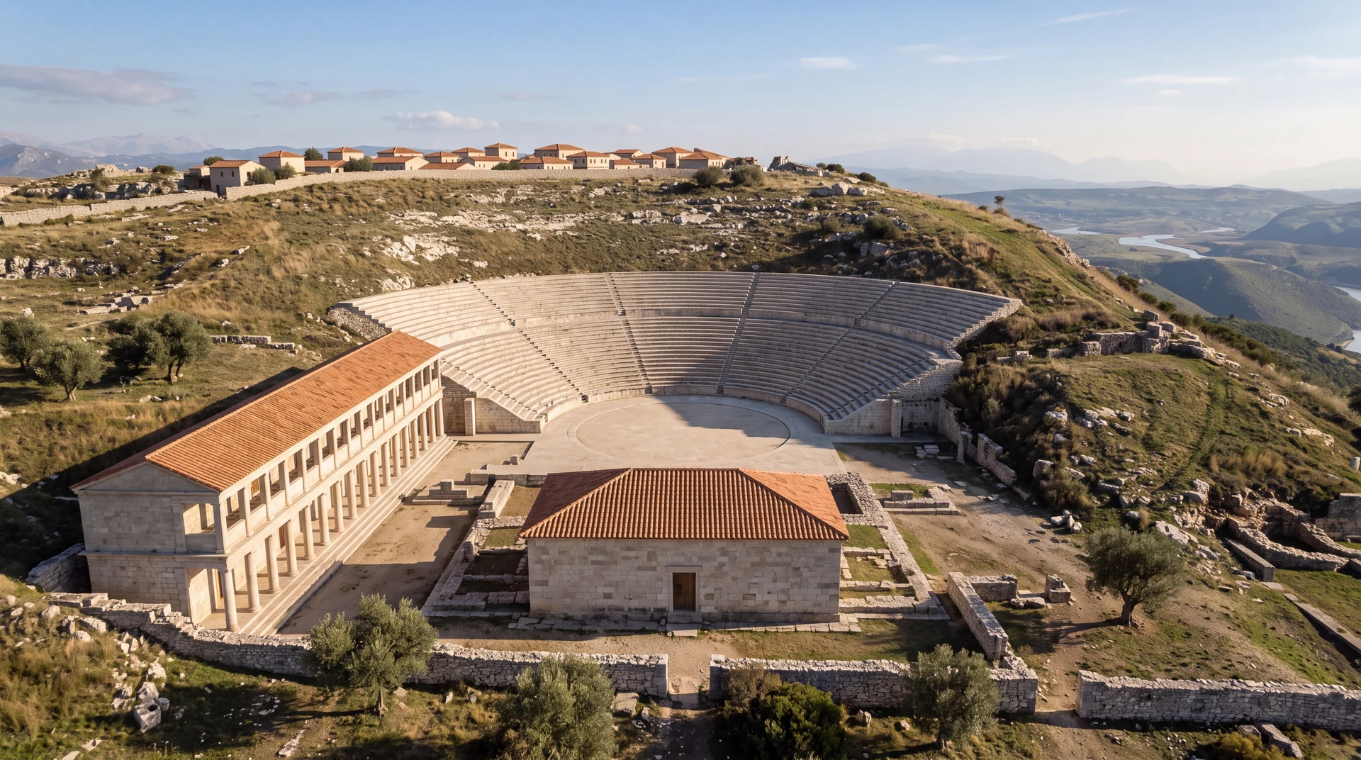
The published description gives the theatre a 78 m diameter, 40 seating rows and a 16 m cavea height. These dimensions anchor this draft of Illyrian Byllis; they have not been checked against a field survey.
The cavea now follows the arrangement in Neritan Ceka’s plan (1993, Tav. IV), reproduced by Ludovica Xavier de Silva in 2023 (fig. 2A, pp. 74–76): five seating wedges, four radial stairways, a cross aisle and straight front retaining walls. The orchestra has a recessed drainage channel and a front row of stone honor seats. Their detailed profiles are interpretations rather than copies of individual surviving stones.
The central seating was cut into the rocky hillside, while the lateral wings relied on retaining masonry. Only parts of the front retaining walls survive. Their reconstructed limestone courses, joints and upper walling illustrate a proposed completed structure; the exact bond, block sizes and ancient ground levels remain uncertain (management plan, pp.43–45).
The stage has two rooms, a rear portico and a central passage leading into the orchestra. The ground arrangement draws on the published plan and ruin photographs. Its wall heights, paired roofs, raised timber platform and column forms are hypotheses; the exact scenic elevation and decorative orders remain unresolved.
Walk through the stage passage, enter the orchestra, or climb any of the four radial stairs. The cross aisle connects the seating sections. Praschniker’s early account also describes a passage between upper and lower seating (Muzakhia und Malakastra, columns 81–82, fig. 33).
The reproduced plan’s scale does not match the published overall diameters exactly. Neritan Ceka’s 1994 Treccani entry gives the cavea an 80.5 m diameter; the different measurement extents remain unresolved. This draft retains the 78 m envelope and uses the drawing for approximate proportions. The 26 lower and 14 upper rows, orchestra radius, drain section and individual stair dimensions are authored choices. Placement now draws on a comparison of the city plan and an aerial photograph; it is not a field survey. Terrain elevations remain proposed, and this is not a model of today’s ruins.
Illyrian theatre · AI reconstruction study from site photographs.02
The theatre stoa
Illyrian civic period · proposed 3rd–2nd century BCE
The theatre stoa is described as 60 × 11.4 m and two storeys, with a Doric lower frontage and Ionic upper order. It is a separate monument from the L-shaped Great Stoa. Surviving foundations and the eastern wall help establish its connection to the theatre.
The reconstruction now has two sheltered aisles, stone shaft drums, course-built walls, exposed floor beams and a tiled roof. Walk through the colonnade and use the staircase to reach the upper gallery. Storey heights, column positions, capital details, floor levels, parapets, roof form and local placement remain proposals. The octagonal shafts documented at the Great Stoa have not been transferred here.
The lower exterior columns are shown with flutes and shaped Doric capitals; the interior shafts remain smooth. The management plan (p. 47, “Stoa B”) identifies the architectural orders but does not provide the missing capital profiles or flute measurements. The illustrated profiles, drum joints and plain stone architrave blocks are therefore reconstruction proposals, not copies of recovered fragments.
The same source describes the lower interior row supporting the upper floor and the row above carrying the roof. The gallery is shown with fitted timber boards, joined beams and seats in the stone supports. Their sizes and connections are proposed: the published beam holes and rock cuttings of the Great Stoa do not establish this building’s lost timber details.
The traditional interpretation associates this building with shelter and social life around the theatre. Rinaldi’s thesis records a later proposal that the southern stoa was an arsenal with three facade entrances, attributed to communication from the excavators. A phase-specific plan is needed before adopting that alternative. It should not be confused with the separate small building currently labelled “arsenal” near the prytaneion.
Limestone and terracotta surfaces follow the material study and ruin photographs; complete elevations and finished ancient surfaces are not preserved. The photo-assisted relationship to the theatre and stadium remains a draft requiring archaeological review.
The common city plan in BCH 132 (2008), p. 924, fig. 1 places this building along the cliff-side enclosure. It supplied the initial shared reference; the present placement also uses the owner’s DJI_0035 aerial photograph. The earlier plan picks spanned about 66 m against the retained 60 m hall, a source discrepancy that the photograph does not resolve. This is not a field survey. The stoa rear wall supplies this part of the visible enclosure. The exact masonry junction, theatre-side annex and construction phases still need review.
03
The Great Stoa
Illyrian civic period · proposed 3rd–2nd century BCE
The Great Stoa is a separate monument from the theatre stoa. The official management plan, pp. 45–46, describes two storeys and two aisles, a 73 m northern arm, a 67 m eastern arm, a 4 m entrance between them and 11.4 m width. These dimensions now guide the model. The stated 144 m total is the sum of the two arm lengths and entrance, not the size of an L-shaped bounding rectangle.
Apollon Baçe and Neritan Ceka’s study, “Shëtitoret e periudhës qytetare ilire” (Monumentet 2/1981, pp. 29–32, fig. 56), records a three-step stylobate, a Doric column setting and interior shafts with an elongated octagonal section, 54 × 50 cm. These distinguish the present model’s frontage and interior supports. Walk up the steps, along either aisle, or up the interpreted staircases to the upper galleries.
The earlier publication proposes shorter wings, 47 m and 53 m; the project website gives 68 m and 73 m. These conflicting descriptions remain in the evidence record. Column spacing is also uncertain: the tentative exterior rhythm and earlier interior spacing have been fitted to the current arm lengths. Complete heights, stairs, roofs, parapets and masonry courses remain reconstruction choices. The upper Ionic order follows the management publication; a conflicting Corinthian description on the website is recorded, and the exact capital profile remains proposed.
Basilica A later reused part of the stoa’s northern wing. Its separate reconstruction study follows the later church phase, while the main city retains the earlier civic building. The two complete roofs are not presented as contemporaneous. Stalls, benches, vessels and textiles evoke public life without reproducing individual excavated objects.
A graded path connects the lower civic forecourt to the raised agora terrace. Its alignment, earth banks and surface are reconstruction choices that make the proposed levels explorable; they do not reproduce a documented ancient ramp.
Illyrian civic period · proposed 3rd–2nd century BCE
Spectators watched athletic contests here while standing. Built around the middle of the third century BCE, the stadium had only one stepped side, supported by the natural hillside. The official management plan, pp. 41–43, records nineteen surviving limestone steps in the better-preserved northern part, each 0.30 m high and 0.40 m deep. Their narrow treads were unsuitable for sitting. Fewer rows survive farther south, where access stairways 0.58 m wide are recorded at intervals of 9.50 m.
The reconstruction proposes nineteen tiers of rectangular limestone blocks along the retained stepped edge. Restoring every row over this length, the smaller access steps, concealed supports and individual stone joints are interpretations. Limestone facings at the two ends and the earth slope joining the terrace to the hillside are also proposed; their complete ancient form is not established by the surviving remains. Large stone troughs collected runoff and allowed sediment to settle before water entered the reservoir beside the steps. Their exact arrangement remains uncertain.
Neritan Ceka’s 1994 Treccani account describes twenty stadium tiers. The model follows the nineteen surviving northern tiers reported in the later management plan; the different counts remain part of the source record.
The published lengths do not agree: the management plan describes a 134 m stepped arm extended to a 180 m stadium course, while the official park account gives about 190 m. The scene retains about 168.5 m of clear earth track and 130.6 m of traced steps from the current plan alignment. These are reconstruction extents, not new measurements of the ancient stadium. The full length, track width and precise placement still require archaeological review.
Olgita Ceka questions both the bases near the prytaneion and a structure beside the southern stoa as starting installations (Candavia 7, p. 201). The reconstruction therefore omits starting markers. The steps belong to Illyrian Byllis’s civic setting; their later reuse at Basilica A is represented through that separate study.
Illyrian civic period · proposed 3rd–2nd century BCE
Olgita Ceka’s study in Candavia 7 describes a 20.08 × 5.73 m building: a long portico between a single western room and two eastern rooms. The side wings project in front of the colonnade. The current ground-floor draft follows this arrangement, replacing the earlier generic hall. The brochure’s 20.1 × 5.8 m dimensions remain in the source record.
The study attributes construction to the middle of the third century BCE and discusses its possible role in civic administration and communal hospitality. Its identification as the prytaneion is an argument, not a settled fact. Roman alterations include changed doorways and a workshop basin; they are described here without folding them into the earlier ground plan.
Enter the recessed portico and its rooms. The east-side door widths, wall arrangement and six rear buttresses follow the study. The colonnade now follows Ceka’s proposed four-column arrangement: 2.34 m intervals along an 11.70 m stylobate. The projecting wings’ hipped roofs and front windows follow the silhouette of the publication’s proposed facade. Individual ashlar blocks, recessed joints and column drums add depth at walking distance.
The proposed facade is not a surviving elevation. Heights, exact stone courses, column profiles and drum divisions, roof pitch, tiles and furniture remain interpretations. The limestone texture is generated, not a scan of this building. The narrow southeast doorway retains its reported 0.67 m clear width and may be easier to inspect in flight.
Source: Olgita Ceka, “Prytaneu i Bylisit / The Prytaneion of Byllis,” Candavia 7, Figs. 1–4, pp. 186–191 and 200–202 (owner-supplied PDF, pp. 2–4 and 9–10). Archaeological review and registration of the building’s city position remain pending.
A gently graded path around the eastern side connects this building with the lower arsenal. The route is an interpretation of circulation between the proposed levels, not an excavated path.
Illyrian civic period · proposed 3rd–2nd century BCE
The relative height difference is a relationship between buildings, not the height of the arsenal itself. Its roof and interior remain conjectural. Later masonry alterations mentioned in the sources are not reproduced as if they belonged to this earlier snapshot.
The arsenal is now placed west of the prytaneion, following Olgita Ceka’s excavation account (Candavia 7, p. 185) and the paired buildings in the BCH general plan (p. 924, fig. 1). The identification and local placement remain provisional. A graded approach connects the two fronts; its form is an interpretation.
Storage vessels and a work surface suggest practical use without claiming an inventory of ancient weapons or equipment.
Illyrian civic period · proposed 3rd–2nd century BCE
Rainwater from the stadium steps and probably the Great Stoa’s roof supplied this reservoir. Built around the middle of the third century BCE, it remained in use into Late Antiquity, when it also supplied baths. The official management plan, pp. 42–43, gives internal dimensions of 50.90 × 4.20 m and a depth of 6.46 m, with six compartments and a reported capacity of 970 m³. Earlier accounts used here give 6 m and about 1,200 m³. The newer dimensions define a rectangular envelope of about 1,381 m³; this is not the usable capacity. The differences remain unresolved.
The cistern lay below ground, with walls partly cut into rock and completed in stone masonry. Limestone arches supported a stone cover at stadium level, while five cross-walls formed six compartments. Mortar mixed with ceramic fragments lined the interior to keep water in and impurities out. The reconstruction follows this documented composition; its colour and the size and abundance of visible fragments are proposed.
The published virtual section suggests how the arches were supported, but their exact supports and spacing are not recovered measurements. Partition height, water level and the small draw opening also remain proposals. Stone troughs for collecting water and allowing sediment to settle are documented; their precise arrangement is uncertain.
The reservoir follows the elongated strip beside the northern stadium steps in the BCH general plan (2008, p. 924, fig. 1). Its alignment and the relationship between its cover, the steps and the running surface still need archaeological review.
Illyrian civic origins · third century BCE; later alterations
Sidi Gorica’s 2014 doctoral study, pp. 132–135 and fig. 33, gives House B’s plan and room dimensions. The reconstruction follows this study: a 9.60 m square Doric courtyard, a southeast entrance, a 7.70 × 6.40 m reception room, and distinct service rooms. Room 4 retains its reported 1.65 m doorway. Roofs, column heights and unmeasured fittings remain proposals.
The retained 29.5 × 24.8 m envelope agrees with that study and the management plan, p. 51. The latter also describes stone courtyard paving, now included. Its north-arrow scheme and south entrance differ from Gorica’s detailed north-arrow plan and east-wall entrance. The schematic labels Plateia B where its accompanying text says C. The model retains the detailed plan’s orientation and records these differences. The park’s annotated aerial also calls the eastern house B, while Gorica distinguishes House A east of the agora and House B on the western hill. The western domestic plot remains provisional; the general plan calls it a Roman house.
House A is modeled separately from Gorica’s fig. 32, with southern principal rooms and a western sequence of service rooms. Its two principal rooms follow the reported clear dimensions, 6.70 × 6.70 m and 8 × 6.70 m. The management plan, p. 50, supplies a 9 m courtyard and 3.5 m entrance. It describes an Ionic courtyard order, used here as a proposal, while Gorica describes Doric columns. The exact capitals, roofs and heights remain interpretations. The remaining houses are representative infill; their worn-earth streets do not establish the surface of every ancient street.
Period: third-century BCE origins, with later alterations. Rooms 5 and 6 in the selected B plan belong to later Roman phases. They retain those phase records in the composite reconstruction. Painted plaster and later burials described by the park are not treated as the earliest Illyrian arrangement.
Illyrian civic period · proposed 3rd–2nd century BCE
The gymnasium is named among the city’s civic monuments. A 43 × 38 m courtyard complex is used here solely as an authoring assumption, with shelter and adjacent rooms.
This is one of the less certain buildings in the scene. Its placement, architectural form, circulation and relationship to education and exercise should be revised against archaeological plans.
Neritan Ceka’s study of Byllis’s urbanism and houses (Iliria 22, 1992, pp. 73–74) describes an orthogonal street system and distinguishes residential, civic and reserved areas. His interpretation identifies the euhorion as a refuge for the surrounding rural population and its movable property. The scene extends this principle through a provisional residential quarter, with stone bases, plaster walls, tiled roofs, doorways, windows and furnished courtyard rooms.
Every generated household has a stable identifier in the build inventory. Future surveyed plans can replace individual plots without replacing the viewer. Empty plots, planting and workshops keep this an interpretation of an inhabited landscape rather than an estimate of ancient population density.
The management plan distinguishes a southern euhorion, reserved for sheltering people from the surrounding countryside during war, from the agora and residential area. That sector is now left open in the Illyrian civic interpretation. Thirteen generic houses and the generated residential street grid have been removed from the selected zone. Its northern extent is schematic; neither the empty field nor its approximate outline establishes the archaeology of every later period.
Illyrian fortifications · later alterations documented
The archaeological project reports roughly 30 hectares and 2,250 m of walls; the official management plan records eight discovered gates. The complete outer boundary has now been traced from the same published plan as the civic monuments. At that plan’s scale, this draft encloses about 33.18 hectares with a 2.76 km boundary, including a natural cliff. This is not a masonry-length figure. Praschniker’s early survey reports 2,550 m. These differences remain unresolved; no rescaling hides the disagreement between the schematic plans and published totals.
Praschniker describes locally quarried limestone in regular courses, inner and outer ashlar faces with rubble between them, and a thickness of 3.40 m. The draft now uses 3.40 m as a typical section, compatible with the park’s description of widths reaching 3.5 m. It is not evidence for one uniform thickness around the city. Gates have individually modeled blocks and open timber leaves; tower interiors have proposed timber stairs and floors. Their positions, elevations and fittings remain interpretations.
At the northern tip, the BCH plan distinguishes a terminal round tower and two successive entrances around an angled fortified court. This group replaces the earlier representative placement of two northern gates on the west side. The official management plan, pp. 37–38, associates the court with construction during 230–167 BCE and describes a round tower 9.60 m in diameter with three wall layers. Its restored internal section, door, timber stair and upper platform remain proposals. Praschniker’s earlier survey described a square terminal tower and could not securely resolve the gates through collapse; that disagreement remains recorded.
The management plan gives the eastern Gate 4 as 10.85 × 8.45 m and about 9 m high. That gateway now has its own reconstruction, with the park guide’s 8.45 m long, 4.20 m wide passage and three arches carried on six supports. Its upper guard room, tiled roof and timber access stair are proposals. The reconstruction uses the earlier full-width entrance; the guide records later narrowing. Eight gateways are now drafted, with different levels of source support; their numeric scene identifiers do not establish the published gate numbering.
Gate 6 now follows the guide’s later Illyrian arrangement: a 7.60 × 2.40 m passage with two successive portals and a 6.10 × 4 m lateral tower. The earlier tower over the passage had already been removed in this interpretation. Two grooves are modeled at the threshold; their depth and spacing, the connecting doorway, tower stair and upper platform are proposals. Byzantine and medieval repairs belong to later phases.
Beside the theatre stoa, Gate 5 runs between overlapping wall arms toward the agora. The guide reports an approximately 7 × 3 m corridor, a portal recessed by 3.60 m and a 9.88 × 8.70 m tower. The draft preserves those controls while proposing the two end arches, their face offsets, the timber access and upper room. The guide’s 8.80 m height is ambiguous; assigning it to the roof ridge is an interpretation. The Roman rebuilding, later narrowing and final closure are recorded as separate phases.
Gate 7 follows the southeastern wall jog identified in the management plan. Its 2.40 m lintelled opening is a proposed section because the accessible sources provide no measured doorway dimensions. The southern cliff is treated separately: the BCH plan replaces masonry lines with cliff marks, and management p.37 describes roughly 200 m left open above impassable rock. Our detailed trace gives about 300 m for that natural span. The wall has been removed there; the length discrepancy and proposed cliff height profile remain explicit.
Farther north on the east side, Praschniker’s postern P has a 3.25 × 1.30 m passage between staggered wall ends, protected by a tower projecting 7.40 m. Its correspondence with the management plan’s Gate 3 is an interpretation. The detailed early plan now replaces the large representative entrance; the tower’s second side is traced from that figure. Its solid lower mass is retained, while the upper platform, parapet, lintel and external timber stair are proposed. The printed width has been checked directly; an earlier 1.60 m OCR reading was incorrect.
Western Gate 8 now follows the overlapping wall ends shown in the general plan. Its approximately 3.60 m gap and 7.50 m overlap are derived from that small drawing, not excavation measurements. The management plan’s conservation programme mentions damaged beams and earth blocking the entrance. A lintelled portal is therefore proposed here, with its material, dimensions, restored wall height and timber leaves kept uncertain. No tower is added at this opening. The same conservation text also mentions a Gate 9 without locating it; its relationship to the eight-gate general plan remains unresolved.
Four projecting towers now follow the general-plan footprints labeled G, E and D on the west and C on the northeast in the management plan. The early survey probably calls C “Q”; the lettering systems are different. The local curtain has been retraced with those footprints, correcting earlier coarse segments that missed the published western line. Each tower’s dimensions come from the drawing, while its hollow lower room, doorway, timber stairs, platform and parapet are reconstruction proposals. Other early tower references still require further source correspondence.
At the northern court’s eastern corner, projection B now follows its visible general-plan footprint, approximately 8.01 × 7.50 m. No lower-room plan is available, so its solid lower mass is a draft choice; gray plan shading alone does not prove that construction. The court wall joins this mass. The upper platform, parapet and external timber stair on its southern side are proposals, and its exact phase relative to the court addition remains unresolved. The unsupported representative tower formerly placed at the southeastern jog has been removed and the curtain restored there.
The city plan in BCH 132 (2008), p. 924, Fig. 1, distinguishes the earlier outer circuit from the later wall along the ridge. The latter is documented separately and has not yet been modeled. The live city combines annotated civic and later buildings; it does not represent one historical date.
The southern stretch beside the theatre stoa retains its detailed source picks within the complete boundary. Building and enclosure share a visible rear wall there; their detailed junction and phasing remain interpretations. Missing masonry lines elsewhere are connected provisionally, and the eight gates and eight separate tower drafts are not claimed to reproduce an excavated numbering sequence.
12
A city on the hill
Across periods · interpretive composite
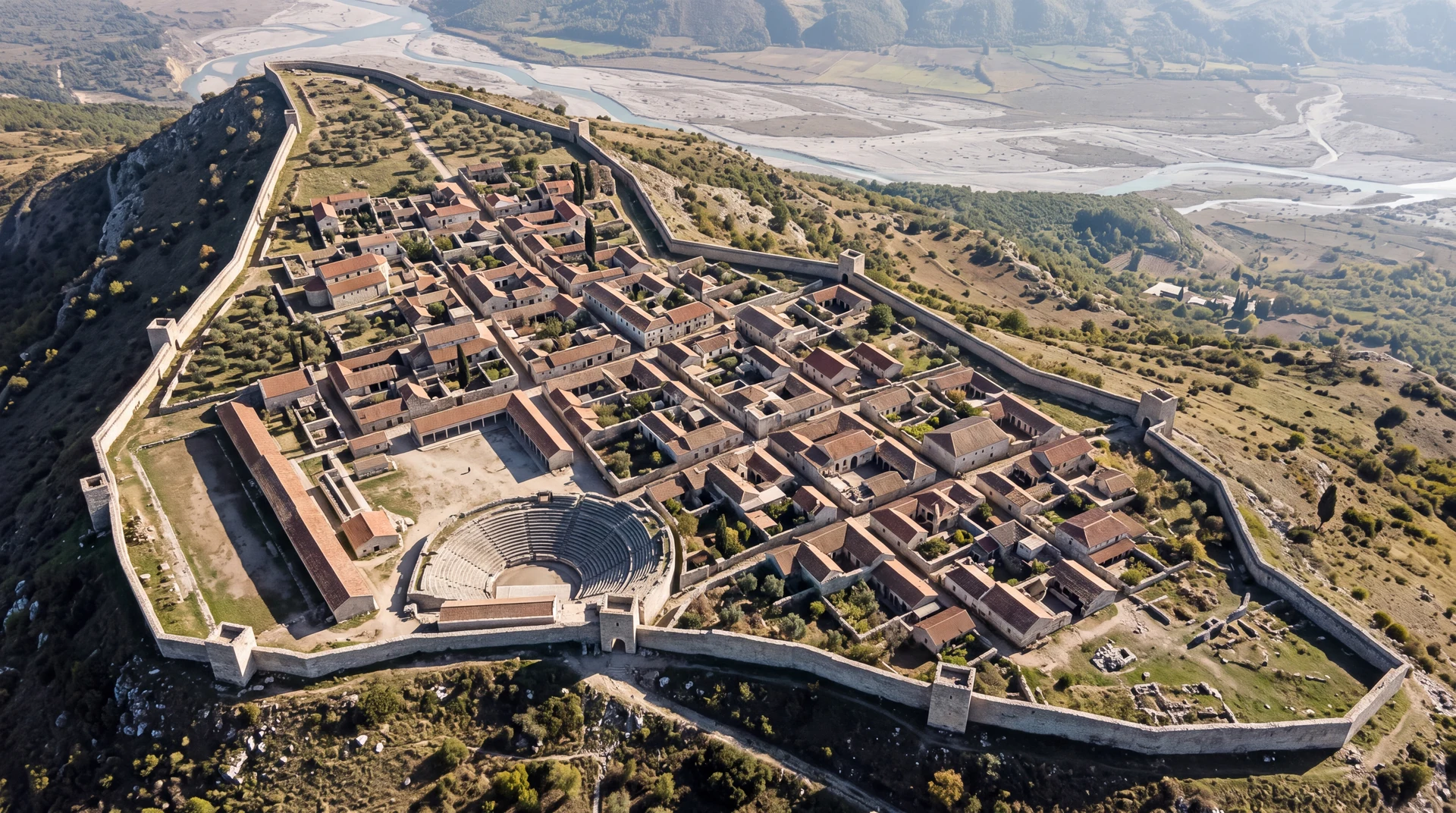
The whole-city interpretation connects public monuments, houses, streets and enclosing walls across a continuous walking landscape. Monument positions and the outer circuit now share a published city-plan frame; terrain heights, planting and most paths remain authored. The scene uses local metres without a surveyed geographic anchor or registered vertical datum.
Olive trees, scrub, exposed stone, warm sunlight and optional nature sounds evoke the setting. The distant mountains and sky use a generated panoramic background. They are an artistic interpretation, not registered geography or terrain that can be walked into.
The earlier theatre–stoa study remains available as a smaller, separate reconstruction. Photographs, plans, models and archaeological review will refine the setting. Present-day comparison will be added where matching ruin data is available.
The published city plan in BCH 132 (2008), p. 924, Fig. 1, adds contours, a north arrow and separate fortification phases. These are now recorded as controls for refinement; they have not been registered to the model’s local heights. The same report documents limestone quarries and extraction traces. Surface textures evoke those materials but are not scans of Byllis itself.
Layered limestone outcrops and irregular cliff relief now give more structure to the exposed ground. Olive crowns, pale plaster, clay roofs and reflected daylight follow the accepted visual study, while their exact positions and ancient appearance remain interpretations. Walking terrain and collision coverage extend around the full revised city outline.
Byllis across time · AI atmosphere study; some placements differ from the authored plan.13
Basilica B and its annexes
Late Antiquity · later than the Illyrian civic buildings
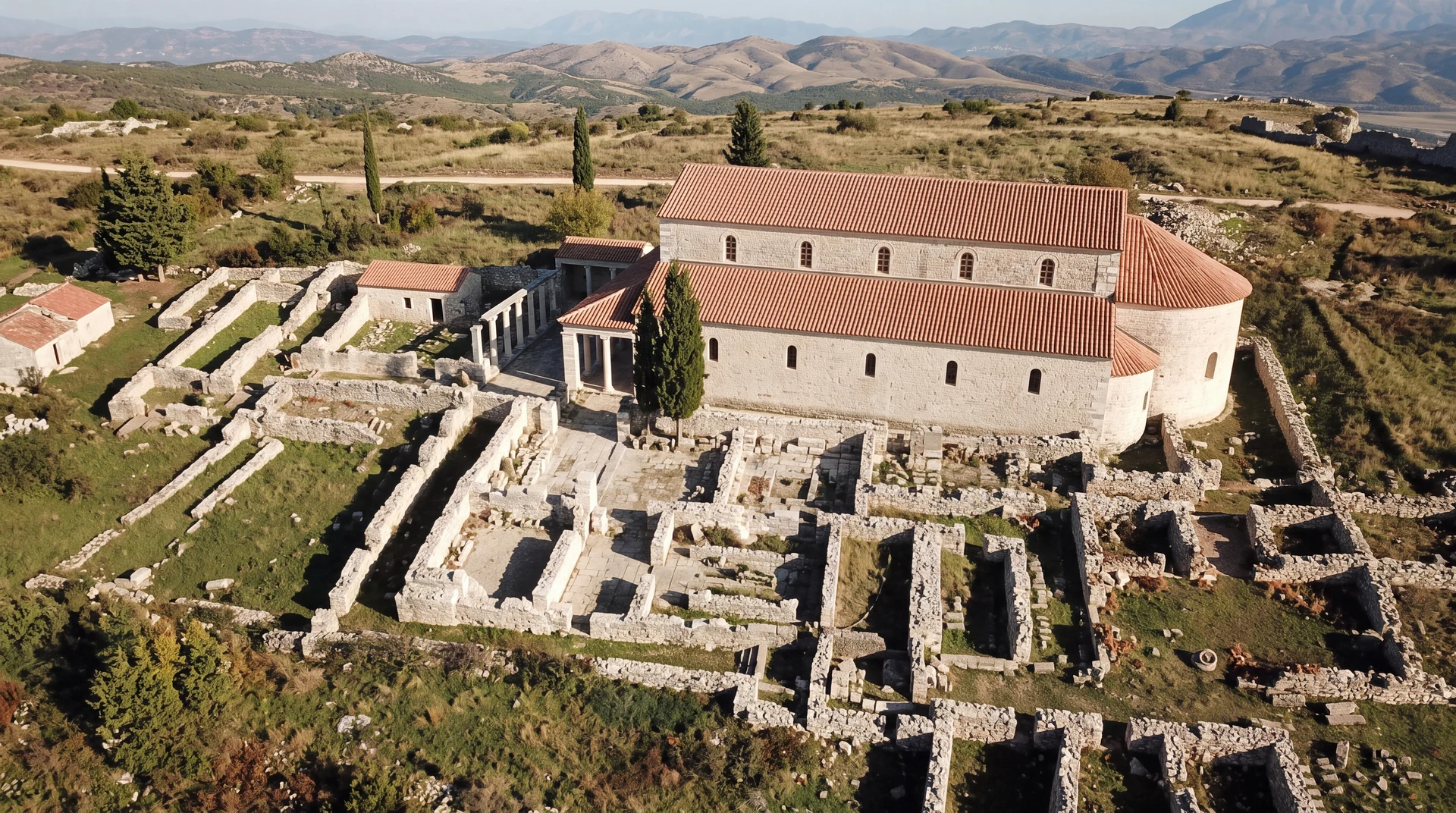
The cathedral’s position follows the city plan in BCH 132 (2008), p. 924, fig. 1. The district plan on p. 926, fig. 2 supplies numbered rooms, courtyard L and two main passages: the west–east route through 12, 26 and M14, and the north–south route through N6 and P2. Forty-nine selected district spaces replace the earlier generic annexes and western approach. Wall axes are simplified from the schematic drawing; they are not a surveyed reconstruction.
The official Bylis–Klos management plan, pp. 59–61, describes the cathedral’s final form with galleries above the aisles, narthex, exonarthex and atrium porticoes. It gives the naos as 24.70 × 14.40 m, with unequal side aisles. The model now has two levels of nave arcades, lower Ionic-impost and upper four-leaf capitals, a three-opening entrance and the documented south-aisle bench. The measured dimensions and oblique schematic trace still have recorded differences; restored heights, bay counts, roof forms and simplified carving remain proposals.
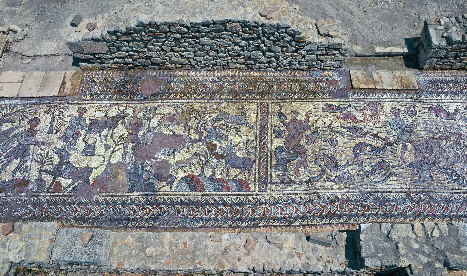
A cropped photograph from the official Bylis–Klos site now supplies a limited mosaic strip in the exonarthex, the outer entrance hall. Muçaj and Raynaud (2005), p. 395, fig. 11 identify its pastoral scene to the north and fishing scene to the south; p. 391 states that the panels face the entrance. The displayed 10.25 × 3.60 m extent and floor height are fitted to the existing model, not measured from the ancient pavement. Two thresholds obscure part of the photograph’s geometric border; those areas, about 5.69% of the derived image, are filled from adjacent portions of that same border as a proposed restoration. The figures’ surviving gaps remain, and no figures are invented or duplicated. The photograph cuts off both ends, so the strip does not reconstruct the complete floor. Exact panel dimensions, placement, ancient colours and the remaining mosaics are unresolved. Muçaj and Raynaud, fig. 11, official source photograph.
The excavation report in BCH 128–129 (2004–2005), pp. 1192–1193, distinguishes an earlier nearly square sanctuary from a later 5.80 × 7.70 m enclosure extended westward. The model now follows the later extent, raised about 0.20 m above the nave, with its axial entry and side passages. It does not add the earlier projecting prostoön. The apse includes a proposed timber bench, following evidence for a compact platform supporting a wooden superstructure. Screen height, carving, timber sections and altar form remain interpretations.
The north aisle wall carries a draft of the painted lattice described on p. 1203, fig. 10: white bands outlined in red, red and grey diamonds, and a grey plinth edged in black. Plaster survives along 4.82 m, at most 10–12 cm high; recognizable decoration survives for less than a metre. The restored panel height, repeat size, exact pigment shades and position along that wall are proposals. The monochrome photograph is a reference for the surviving motif, not a complete image of the restored wall.
West of the church, the drawing distinguishes rooms 3–6 and 8, atrium 7, and the approach through spaces 12, 11 and 10 into the continuous narthex 14. The atrium court follows the published 11.15 × 6.80 m dimensions. Its lower Doric and upper Ionic arcades stand on a high stylobate, without stairs into the court. The northeastern exonarthex stair follows the documented location; its return flights and upper-floor height are proposed. The fragmentary outlines of spaces 1 and 9 remain unresolved. The excavated eastern district contains economic and service spaces; the bishop’s unexcavated lodging is not identified among these modeled rooms.
The excavation report informs several interiors. Room 33 contained sixteen storage-vessel bases; N2 had a 6.30 × 0.95 m bench divided into three compartments. N5 contained a 1.65 × 1.45 m treading basin and a reused limestone tub. The modeled fixtures use those reported dimensions, while vessel shapes and missing upper parts are interpretations. Repeated hearths support the interpretation of P1 as a kitchen. K4’s northern door was blocked in its last state, so entry is kept on its southern side. These details come from different documented episodes and do not establish one fully furnished historical moment.
The baptistery entrance follows the three arches drawn in management fig. 39, with 6.05 m between the outer jambs, 1.57 m shafts and 0.78 m pedestals. Figure 40 supplies the northern pedestal’s face dimensions; its molding and cross are simplified in the model. The southern support, arch construction and alignment with the schematic room plan remain proposed. A northern passage leads around the partition into the baptismal room. The detailed phase plan in BCH 128–129 (2004–2005), pp. 1193–1195, fig. 3 now replaces the square general-plan symbol. The displayed third pool is cruciform, with rounded northern and southern ends, east–west inset steps, cipolin marble lining and a proposed six-tone mosaic floor. Four piers support a roof lantern, with an actual opening through the surrounding roof. The selected outline follows the publication’s phase reconstruction; pool depth, stair sections, marble shades, mosaic arrangement and lantern heights are proposals. The earlier quadrangular and quadrilobed pools, and the third pool’s later mortar reductions, blocked northern arm and probable bishop’s platform, remain distinct phases rather than overlapping reconstructions.
The western atrium portico contains the documented pear-shaped cistern, reported as 8.45 m deep. Its chamber section, lining and closed draw cover are proposed. The buried reservoir is not presented as an accessible underground room.
Period: Late Antiquity. It appears beside reconstructed Illyrian civic buildings in an explicitly composite city; these are not claimed to have coexisted in their displayed condition.
Late Antique complex · AI form study; upper structures are hypothetical.14
Basilica C in the earlier agora
Second quarter of the sixth century CE · later church
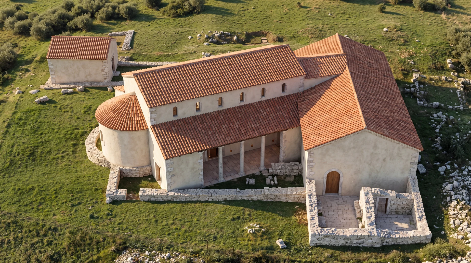
The city plan in BCH 132 (2008), p. 924, fig. 1 identifies Basilica C west of the stadium. The park’s monument 11 and its captioned ground photograph provide a separate identity check. Basilica E lies farther east and is a different building. Reference photograph 10 closely matches C’s distinctive annexes, western halls, apse and central stone pavement in the detailed survey. This is an identification from the footprint, not a recovered original photograph caption or surveyed camera position.
The detailed May 2000 survey, reproduced on p. 279 of the official management plan, now supplies the wall outlines, exonarthex, narthex and six annexes. The published 33 × 22.80 m dimensions describe the whole complex; they are not the width of its church body. The source gives a 5.80 m central nave and narrower side aisles. Its plan and these measurements still have recorded differences that require archaeological review.
The model includes a central stone pavement, monolithic columns with simplified Ionic-impost capitals, parapet screens between the arcades, aisle benches and a three-step synthronon behind the altar. The narthex has an upper gallery. The position of its northern stair follows the drawing, while the return flights, door heights, roofs and other upper dimensions are proposals. Sanctuary and annex mosaics are documented, but their exact panels have not yet been reconstructed.
The park dates construction to the second quarter of the sixth century CE and records an earlier house and cistern below the nave. Those buried structures are not presented as a newly verified underground route.
Period: Late Antiquity. Its presence beside the Illyrian theatre, stoas and stadium is intentional in this annotated composite. It is not evidence for an Illyrian-period church.
Smaller later basilica · AI form study from reference 10.15
Basilica D near the northern entrance
Late Antiquity · expanded church before mid-sixth-century reuse
Basilica D stands near the northern entrance, outside the later wall of Victorinus. The official management plan describes an early sixth-century church, followed by destruction around the middle of that century and residential reuse of its porticoes. This reconstruction shows the earlier church. It belongs to Late Antiquity, centuries after the Illyrian civic buildings shown elsewhere in this annotated composite.
The park guide instead dates the earliest church to the beginning of the fifth century and identifies the atrium as a later addition. That disagrees with the management plan’s early-sixth-century date. The model combines the published expanded church plan before residential reuse; the construction sequence and earliest date remain disputed.
The May 2001 survey reproduced in figure 26 supplies its three aisles, semicircular apse with three buttresses, narthex, two annexes, four-sided atrium and simple western propylon. The published maximum dimensions are 45.25 × 26.15 m. Its position follows the BCH city plan; the smaller general-plan symbol does not justify shrinking the detailed survey.
Unlike the columns of Basilicas B and C, D has low arcades on masonry piers and a high stylobate. Thin masonry partitions between the piers also form seating benches. Surviving arcades establish a gallery-floor range of 3.80–4.00 m; the draft uses 3.90 m. The southwest narthex stair leads to galleries above the narthex and aisles. Its flights, upper piers, windows and roofs remain proposals. The later south-portico stair belongs to another phase.
The sanctuary has a high screen and two straight synthronon steps with a timber podium. A cross-shaped relic deposit beneath the altar and a barrel-vaulted tomb below the northern aisle are recorded in the sources. The model retains covered floors above these buried features. Documented mosaics include animals, birds, inscriptions and the named Rivers of Paradise; their exact panels have not yet been reproduced.
BCH describes D’s construction as opus mixtum, combining mortared stone and brick. The model now uses rubble masonry, brick bands and proposed brick arch rings. Their exact spacing and extension into the reconstructed upper walls are interpretation. D’s documented floor mosaics and the distribution of marble and brick paving still need more detailed reconstruction.
Period: expanded church before mid-sixth-century reuse; earliest date disputed. Confidence: published plan and gallery-height range; proposed upper fabric, brick spacing and fittings.
Basilica E stands east of the later wall of Victorinus, inside the older city circuit. It is distinct from Basilicas C and D. The conservation inventory dates it to the sixth century CE. A hearth in the exonarthex abandonment layer produced a radiocarbon date of 595–610; that dates the sampled abandonment material, not the church’s construction.
The published account places the main 2 m entrance at the northern end of the exonarthex. Its western facade had a large window group with seven mullions and no doorway. This draft interprets the seven mullions as eight openings. The exonarthex partly used cut and leveled limestone bedrock, with packed earth in hollows. A single arch, rather than a three-part tribelon, connected the narthex to the central nave.
The management narrative gives a maximum 33 × 22.80 m envelope; its conservation sheet gives 24.60 × 19.22 m. The draft uses the latter while preserving the conflict. Its room subdivision follows textual relationships and photographs, pending a detailed survey. More specific published controls include the 4.33 × approximately 5.20 m sanctuary, the 0.79 × 1.28 m prostoön and the 7.90 × 5.30 m nave mosaic.
Masonry piers, bench-like parapets, reused stone and brick bands distinguish E’s construction. The modeled brick rhythm is a proposal informed by the surviving fabric. Galleries above the narthex and aisles are documented from the first phase, but their heights, the return stair and roofs remain proposed. The pierced sanctuary screens, colored stucco and sanctuary mosaics still need detailed reconstruction. The two low ambo bases refer to the published remains; they do not establish a complete original pulpit.
Period: Late Antiquity. Confidence: published entrance and internal controls; unresolved overall dimensions and proposed upper fabric. The church is shown alongside Illyrian civic architecture as an annotated composite, not as a building of the Illyrian period.
The nave now has a draft reconstruction of its published 7.90 × 5.30 m mosaic: four main panels, braided borders, the dog, hare and dolphins, four interlaced circles, and the eastern bird, fish, basket and geometric scenes. The white marble ground and yellow scales are documented. Other colors, completed missing contours and the regular laying of individual tesserae are proposals from a monochrome photograph. The sanctuary’s different workshop, incomplete panels and prostoön inscription have not been invented or copied into this nave carpet.
Site photographs, surveyed models and archaeological sources will guide the next chapter. Each reconstruction will document what is known and what is inferred.